ZCZC MIATWOEP ALL
TTAA00 KNHC DDHHMM
Tropical Weather Outlook
NWS National Hurricane Center Miami FL
500 AM PDT Thu Oct 28 2021
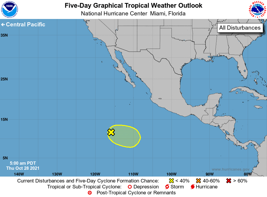
For the eastern North Pacific...east of 140 degrees west longitude:
1. Showers and thunderstorms have increased overnight in association
with a broad area of low pressure located several hundred miles
south-southwest of the southern tip of the Baja California
peninsula. Some slow development of this system is possible over
the next couple of days as it meanders over the open eastern
Pacific waters. By late this weekend and early next week,
environmental conditions are expected to become unfavorable for
further development.
* Formation chance through 48 hours...low...20 percent.
* Formation chance through 5 days...low...20 percent.
Forecaster Latto/Hagen