ZCZC MIATWOEP ALL
TTAA00 KNHC DDHHMM
Tropical Weather Outlook
NWS National Hurricane Center Miami FL
1100 AM PDT Thu Oct 21 2021
For the eastern North Pacific...east of 140 degrees west longitude:
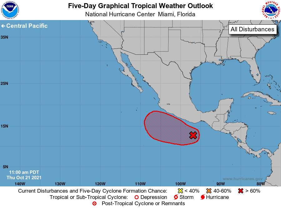
1. Disorganized showers and thunderstorms within a few hundred miles of
the southern coast of Mexico are associated with a broad area of
low pressure located just to the southwest of the Gulf of
Tehuantepec. Environmental conditions are expected to be
conducive for gradual development of this system during the next
several days, and a tropical depression is likely to form by this
weekend while the system moves slowly west-northwestward to
northwestward near or just offshore the southern coast of Mexico.
* Formation chance through 48 hours...medium...50 percent.
* Formation chance through 5 days...high...90 percent.
Forecaster Latto