ZCZC MIATWOEP ALL
TTAA00 KNHC DDHHMM
Tropical Weather Outlook
NWS National Hurricane Center Miami FL
1100 PM PDT Wed Sep 29 2021
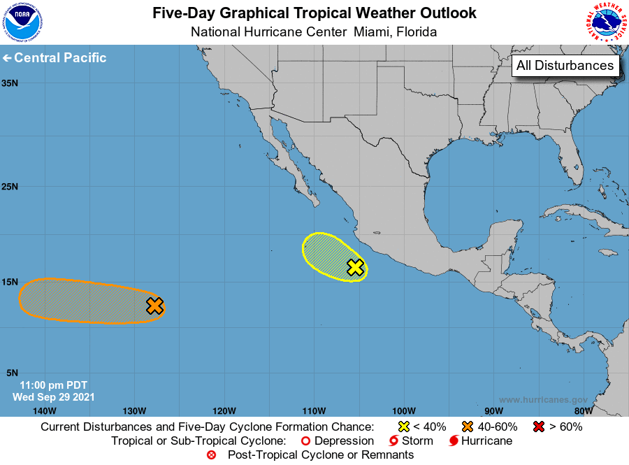
For the eastern North Pacific...east of 140 degrees west longitude:
1. A broad area of low pressure located about 1400 miles southwest
of the southern tip of the Baja California peninsula is producing
disorganized showers and thunderstorms. Environmental conditions
are expected to be conducive for slow development during the next
several days, and a tropical depression could form over the weekend
or early next week while the system moves generally westward at
around 10 mph.
* Formation chance through 48 hours...low...20 percent.
* Formation chance through 5 days...medium...40 percent.
2. Cloudiness and showers remain disorganized near a broad area of low
pressure located a couple of hundred miles south-southwest of
Manzanillo, Mexico. Any development of this system during
the next day or two should be slow to occur while it moves toward
the west-northwest at 5 to 10 mph and reaches an area of stronger
upper-level winds by Friday or Friday night.
* Formation chance through 48 hours...low...10 percent.
* Formation chance through 5 days...low...10 percent.
Forecaster Berg