ZCZC MIATWOEP ALL
TTAA00 KNHC DDHHMM
Tropical Weather Outlook
NWS National Hurricane Center Miami FL
500 PM PDT Tue Sep 21 2021
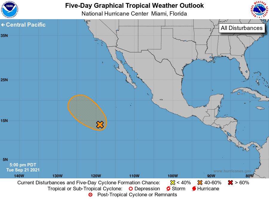
For the eastern North Pacific...east of 140 degrees west longitude:
1. A broad area of low pressure located over 800 miles southwest of the
southern tip of the Baja California peninsula continues to produce
some disorganized shower activity. Environmental conditions are
somewhat conducive for development, and a short-lived tropical
depression could form by late this week while the low moves
generally northwestward at 10 to 15 mph. This system is forecast to
move over cooler waters and into a more stable environment by the
weekend, which should inhibit further development.
* Formation chance through 48 hours...low...30 percent.
* Formation chance through 5 days...medium...50 percent.
Forecaster Reinhart