ZCZC MIATWOEP ALL
TTAA00 KNHC DDHHMM
Tropical Weather Outlook
NWS National Hurricane Center Miami FL
1100 AM PDT Sun Sep 12 2021
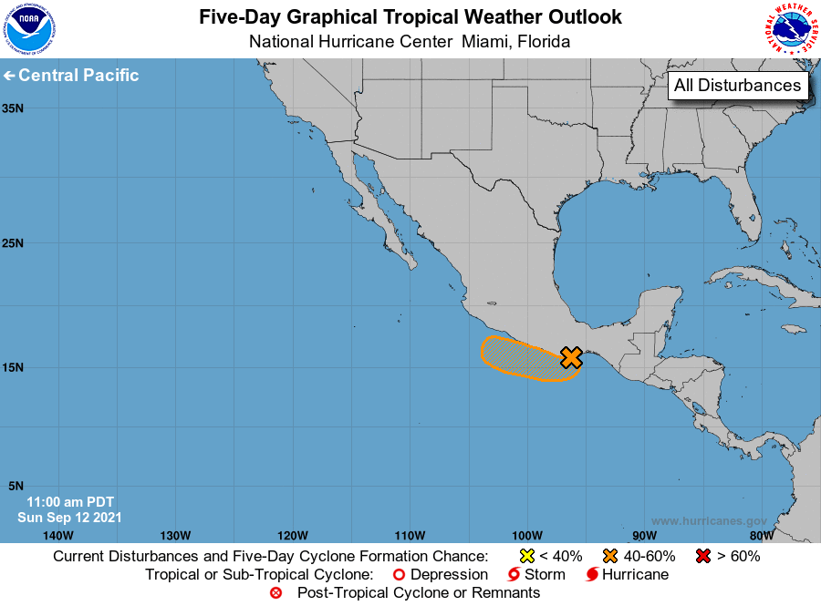
For the eastern North Pacific...east of 140 degrees west longitude:
1. An area of low pressure located near the southeastern coast of
Mexico just to the southwest of Puerto Angel is producing
disorganized shower and thunderstorm activity. Further development
of this system is unlikely today now that the low is interacting
with land. However, a tropical depression could still form if the
system moves westward away from the coast of southern Mexico during
the next few days. Regardless of development, this system will
likely produce heavy rains across portions of southern Mexico
through Tuesday.
* Formation chance through 48 hours...medium...40 percent.
* Formation chance through 5 days...medium...40 percent.
Forecaster Stewart