ZCZC MIATWOEP ALL
TTAA00 KNHC DDHHMM
Tropical Weather Outlook
NWS National Hurricane Center Miami FL
500 AM PDT Sat Sep 11 2021
For the eastern North Pacific...east of 140 degrees west longitude:
The National Hurricane Center has issued its last advisory on
Post-Tropical Cyclone Olaf, located about 100 miles west-southwest
of Cabo San Lazaro, Mexico.
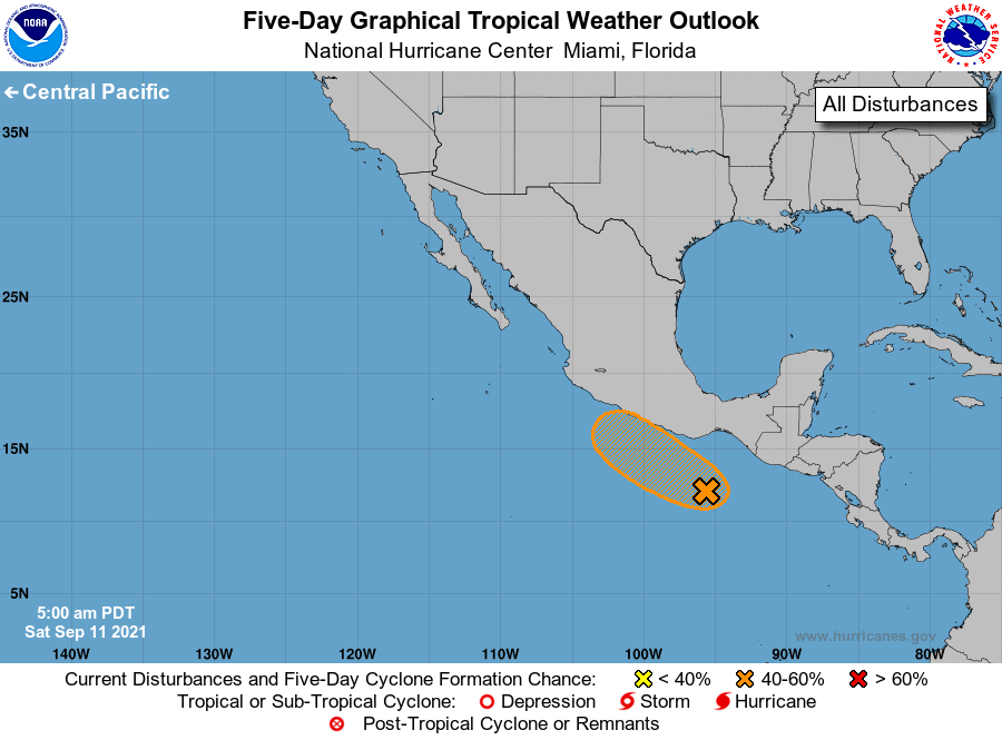
1. A broad area of low pressure appears to be forming a couple of
hundred miles south-southwest of the Gulf of Tehuantepec. This
system is producing a large area of disorganized showers and
thunderstorms extending from the coast of Mexico to several hundred
miles offshore. Gradual development of this system is possible if
it remains over water, and a tropical depression could form during
the next couple of days while moving west-northwestward very near
the southern and southwestern coasts of Mexico. Regardless of
development, this system will likely produce heavy rains across
portions of Central America and southern Mexico during the next few
days.
* Formation chance through 48 hours...medium...60 percent.
* Formation chance through 5 days...medium...60 percent.
Forecaster Cangialosi/Reinhart