ZCZC MIATWOEP ALL
TTAA00 KNHC DDHHMM
Tropical Weather Outlook
NWS National Hurricane Center Miami FL
500 AM PDT Fri Sep 10 2021
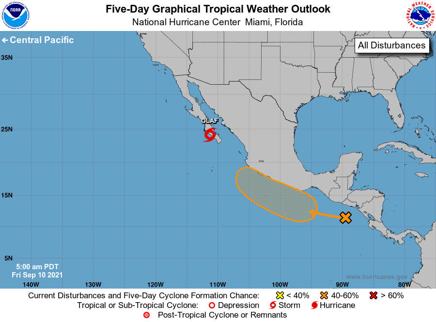
For the eastern North Pacific...east of 140 degrees west longitude:
The National Hurricane Center is issuing advisories on Hurricane
Olaf, located over southern Baja California Sur, Mexico.
1. A large area of disorganized showers and thunderstorms near the
Pacific coast of Central America and the adjacent waters are
associated with the southern portion of a tropical wave. A broad
area of low pressure is expected to form along this wave south of
the southern coast of Mexico during the next day or two, and the low
could then develop further into a tropical depression late this
weekend or early next week while it moves west-northwestward or
northwestward near the southern and southwestern coasts of Mexico.
Regardless of development, this system is likely to produce heavy
rains across portions of Central America and southern Mexico during
the next few days.
* Formation chance through 48 hours...low...30 percent.
* Formation chance through 5 days...medium...60 percent.
Forecaster Cangialosi