ZCZC MIATWOEP ALL
TTAA00 KNHC DDHHMM
Tropical Weather Outlook
NWS National Hurricane Center Miami FL
1100 AM PDT Mon Aug 23 2021
For the eastern North Pacific...east of 140 degrees west longitude:
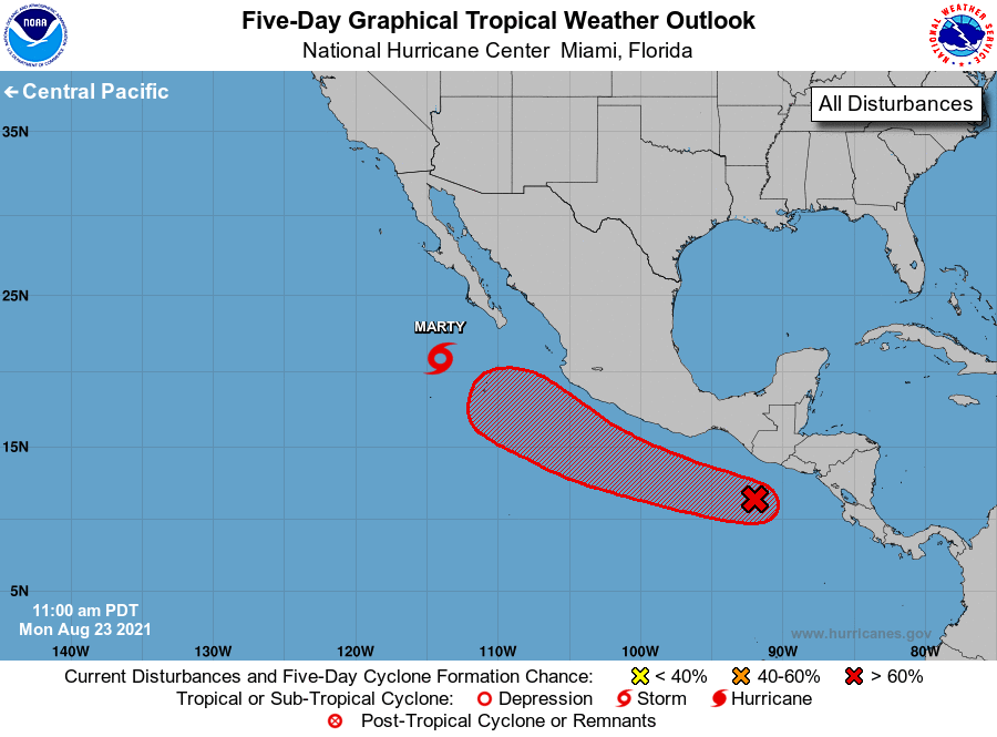
The National Hurricane Center is issuing advisories on Tropical
Storm Marty, located more than 200 miles south-southwest of the
southern tip of the Baja California peninsula.
1. An area of disturbed weather centered less than 200 miles south of
Guatemala and southeastern Mexico is producing a broad area of
disorganized showers and thunderstorms. Environmental conditions are
forecast to be favorable for gradual development of this system, and
a tropical depression is likely to form by the middle to latter
part of this week. The disturbance is expected to move westward to
west-northwestward at 10 to 15 mph, remaining offshore the coast of
southwestern Mexico through this week.
* Formation chance through 48 hours...medium...50 percent.
* Formation chance through 5 days...high...90 percent.
Public Advisories on Tropical Storm Marty are issued under WMO
header WTPZ33 KNHC and under AWIPS header MIATCPEP3.
Forecast/Advisories on Tropical Storm Marty are issued under WMO
header WTPZ23 KNHC and under AWIPS header MIATCMEP3.
Forecaster Stewart