ZCZC MIATWOEP ALL
TTAA00 KNHC DDHHMM
Tropical Weather Outlook
NWS National Hurricane Center Miami FL
1100 AM PDT Sat Jul 31 2021
For the eastern North Pacific...east of 140 degrees west longitude:
The National Hurricane Center is issuing advisories on Tropical
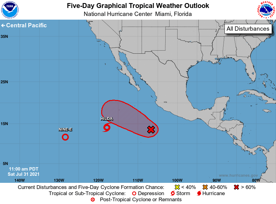
Storm Hilda, located about 800 miles southwest of the southern tip
of the Baja California peninsula, and on Tropical Depression Nine-E,
located about 1400 miles west-southwest of the southern tip of the
Baja California peninsula.
1. Showers and thunderstorms continue to show signs of organization in
association with a broad area of low pressure located about 400
miles southwest of the coast of southern Mexico. Continued gradual
development of this system is expected, and a tropical depression is
likely to form in a couple of days before environmental conditions
become less conducive for development. This disturbance is expected
to move west-northwestward at 10 to 15 mph, away from the coast of
Mexico.
* Formation chance through 48 hours...medium...60 percent.
* Formation chance through 5 days...high...70 percent.
Forecaster Cangialosi