ZCZC MIATWOEP ALL
TTAA00 KNHC DDHHMM
Tropical Weather Outlook
NWS National Hurricane Center Miami FL
1100 AM PDT Tue Jul 27 2021
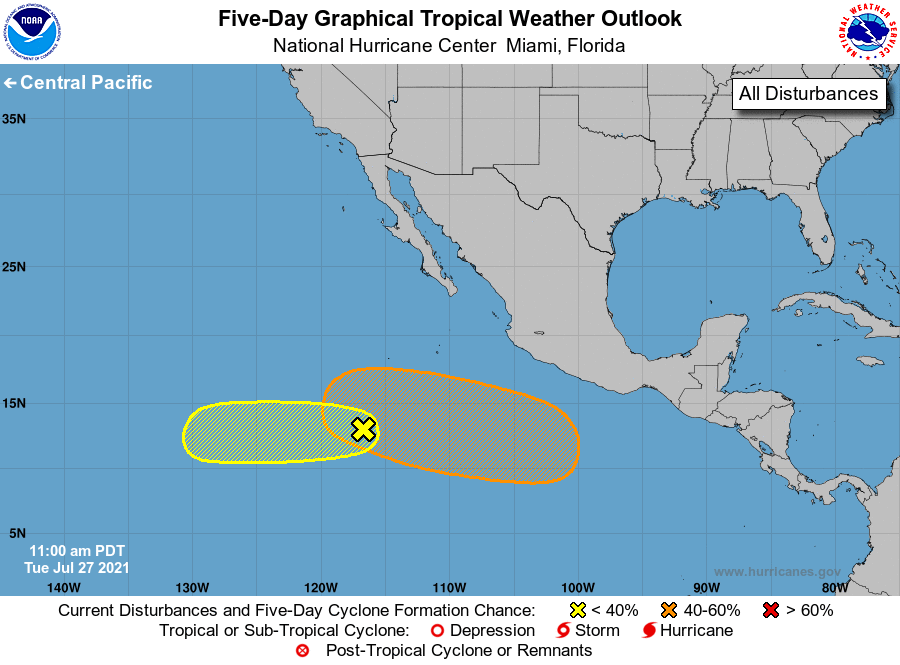
For the eastern North Pacific...east of 140 degrees west longitude:
1. A low-pressure system located over 800 miles south-southwest of the
southern tip of the Baja California peninsula continues to produce
disorganized showers and thunderstorms near and to the southeast of
its center. Environmental conditions appear marginally conducive
for some gradual development of this system over the next several
days as it moves westward at around 10 mph.
* Formation chance through 48 hours...low...20 percent.
* Formation chance through 5 days...low...30 percent.
2. An area of low pressure is expected to develop later this week
several hundred miles offshore of the southern coast of Mexico.
Environmental conditions are forecast to be favorable for some
gradual development thereafter, and a tropical depression could form
this weekend while the system moves westward or west-northwestward
at around 10 to 15 mph.
* Formation chance through 48 hours...low...near 0 percent.
* Formation chance through 5 days...medium...40 percent.
Forecaster Reinhart/Pasch