ZCZC MIATWOEP ALL
TTAA00 KNHC DDHHMM
Tropical Weather Outlook
NWS National Hurricane Center Miami FL
500 AM PDT Tue Jul 13 2021
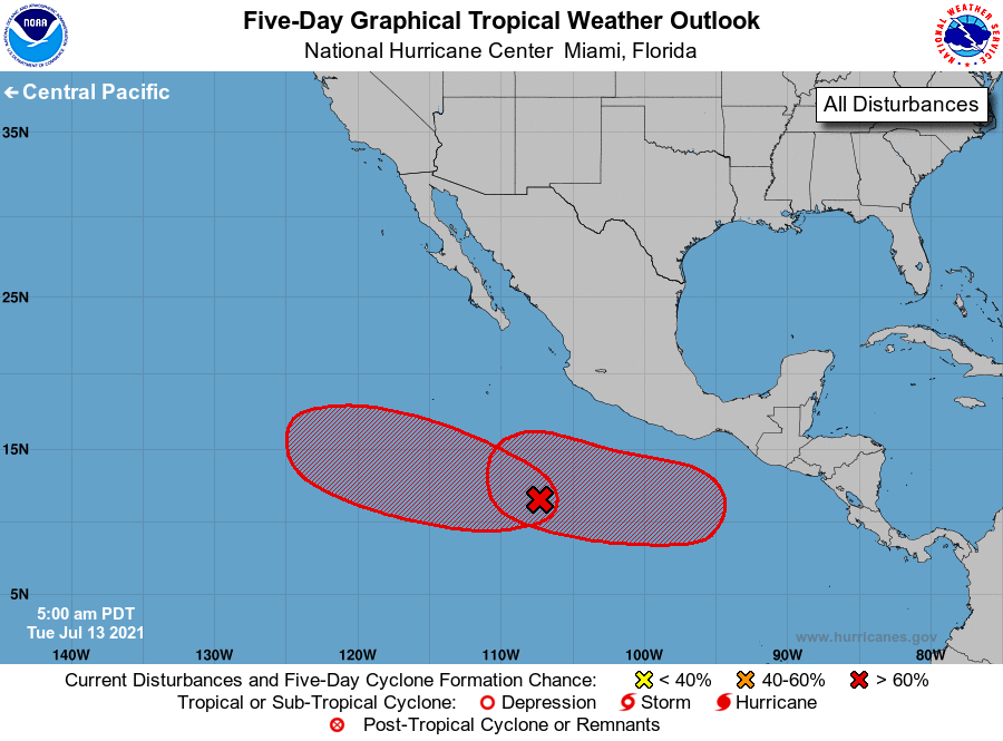
For the eastern North Pacific...east of 140 degrees west longitude:
1. A broad area of low pressure, located about 800 miles
south-southeast of the southern tip of the Baja California
peninsula, is producing a small but concentrated area of showers
and thunderstorms. Environmental conditions are forecast to be
favorable for development, and a tropical depression is likely
to form in a couple of days while the low moves westward to
west-northwestward at 10 to 15 mph.
* Formation chance through 48 hours...medium...60 percent.
* Formation chance through 5 days...high...80 percent.
2. An area of low pressure is forecast to develop south or southwest
of the Gulf of Tehuantepec late this week and move westward at 10
to 15 mph, well offshore of the southern coast of Mexico.
Environmental conditions are expected to be favorable for gradual
development, and a tropical depression is likely to form this
weekend.
* Formation chance through 48 hours...low...near 0 percent.
* Formation chance through 5 days...high...70 percent.
Forecaster Brown