ZCZC MIATWOEP ALL
TTAA00 KNHC DDHHMM
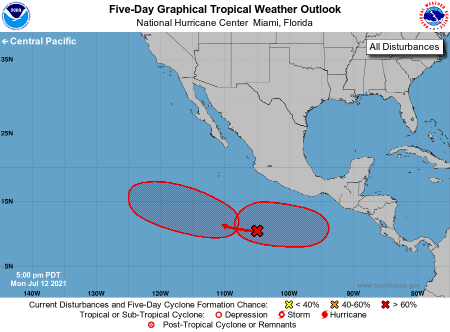
Tropical Weather Outlook
NWS National Hurricane Center Miami FL
500 PM PDT Mon Jul 12 2021
For the eastern North Pacific...east of 140 degrees west longitude:
1. Disorganized showers and thunderstorms continue in association with
a broad area of low pressure located several hundred miles south of
Manzanillo, Mexico. Environmental conditions are expected to remain
conducive for gradual development, and a tropical depression is
likely to form later this week well offshore of the southwestern
coast of Mexico while the system moves westward to
west-northwestward at 10 to 15 mph.
* Formation chance through 48 hours...medium...50 percent.
* Formation chance through 5 days...high...80 percent.
2. An area of low pressure is forecast to develop south of the Gulf of
Tehuantepec later this week and move westward at 10 to 15 mph, well
offshore of the southern coast of Mexico. Environmental conditions
are forecast to be favorable for development of this system, and a
tropical depression is likely to form by this weekend.
* Formation chance through 48 hours...low...near 0 percent.
* Formation chance through 5 days...high...70 percent.
Forecaster Reinhart/Pasch