ZCZC MIATWOEP ALL
TTAA00 KNHC DDHHMM
Tropical Weather Outlook
NWS National Hurricane Center Miami FL
500 AM PDT Sun Jul 11 2021
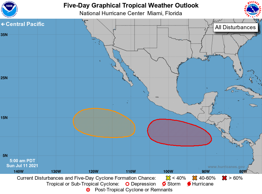
For the eastern North Pacific...east of 140 degrees west longitude:
1. An area of low pressure is forecast to develop southeast or south
of the Gulf of Tehuantepec in the next few days and move generally
westward or west-northwestward at 10 to 15 mph, well offshore the
southern coast of Mexico. Environmental conditions are expected to
support gradual development of this system, and a tropical
depression is likely to form around mid-to-late week.
* Formation chance through 48 hours...low...near 0 percent.
* Formation chance through 5 days...high...70 percent.
2. Another area of low pressure is expected to form several hundred
miles southwest of the southern coast of Mexico within the next
few days. Gradual development of this system is possible while it
moves westward or west-northwestward at 10 to 15 mph.
* Formation chance through 48 hours...low...near 0 percent.
* Formation chance through 5 days...medium...40 percent.
Forecaster Brown