ZCZC MIATWOEP ALL
TTAA00 KNHC DDHHMM
Special Tropical Weather Outlook
NWS National Hurricane Center Miami FL
800 AM PDT Fri May 7 2021
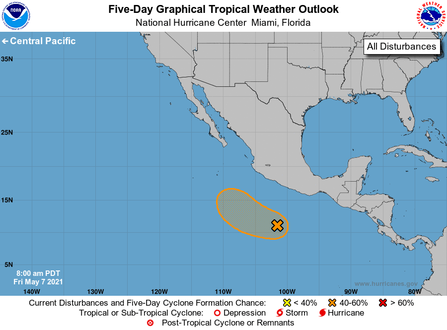
For the eastern North Pacific...east of 140 degrees west longitude:
Special Tropical Weather Outlook issued for an area of disturbed
weather southwest of Mexico.
1. An area of low pressure located several hundred miles southwest of
the southern coast of Mexico is producing disorganized showers and
thunderstorms. Development of this system is possible during the
next few days, and a short-lived tropical depression or tropical
storm could form over the weekend or early next week while moving
west-northwestward at about 10 mph.
* Formation chance through 48 hours...medium...40 percent.
* Formation chance through 5 days...medium...60 percent.
The next Special Tropical Weather Outlook on this system will be
issued by 8 PM PDT this evening, or earlier if conditions warrant.
Forecaster Berg