ZCZC MIATWOEP ALL
TTAA00 KNHC DDHHMM
Tropical Weather Outlook
NWS National Hurricane Center Miami FL
1000 AM PST Mon Nov 16 2020
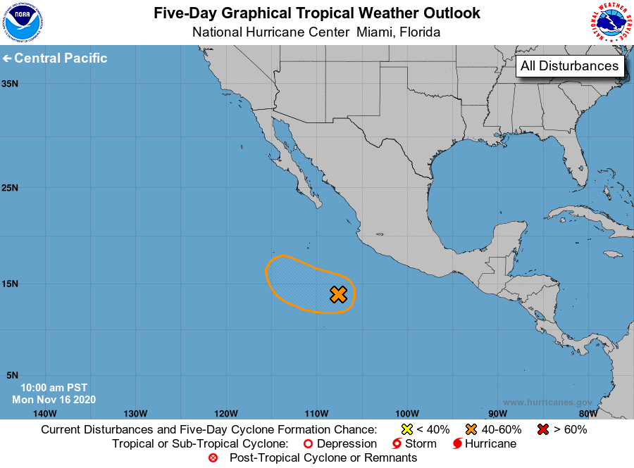
For the eastern North Pacific...east of 140 degrees west longitude:
1. Showers and thunderstorms associated with a broad area of low
pressure located several hundred miles southwest of the coast of
southern Mexico have increased and become a little better
organized since yesterday. Although environmental conditions are
forecast to be only marginally conducive, some additional
development is possible, and the system could become a short-lived
tropical depression within the next couple of days. The low is
forecast to move west-northwestward or northwestward at about 10 mph
away from the coast of Mexico. Conditions are expected to become
unfavorable for further development around midweek.
* Formation chance through 48 hours...medium...40 percent.
* Formation chance through 5 days...medium...40 percent.
Forecaster Brown