ZCZC MIATWOEP ALL
TTAA00 KNHC DDHHMM
Tropical Weather Outlook
NWS National Hurricane Center Miami FL
400 AM PST Mon Nov 16 2020
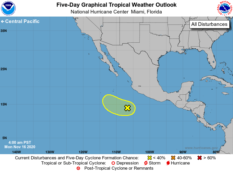
For the eastern North Pacific...east of 140 degrees west longitude:
1. Showers and thunderstorms associated with a broad area of low
pressure located several hundred miles southwest of the coast of
southern Mexico have become a little better organized overnight.
Environment conditions, however, are only marginally conducive,
and any additional development of this system is expected to be
slow to occur over the next few days. The disturbance is forecast
to move slowly west-northwestward or northwestward away from
the coast of Mexico. Conditions are expected to become unfavorable
for further development around midweek.
* Formation chance through 48 hours...low...20 percent.
* Formation chance through 5 days...low...30 percent.
Forecaster Brown