ZCZC MIATWOEP ALL
TTAA00 KNHC DDHHMM
Tropical Weather Outlook
NWS National Hurricane Center Miami FL
400 PM PST Sat Nov 14 2020
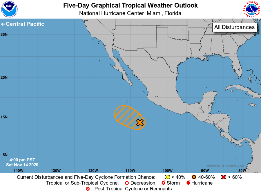
For the eastern North Pacific...east of 140 degrees west longitude:
1. A broad and disorganized area of low pressure located several
hundred miles southwest of the coast of southern Mexico is producing
limited shower activity. Environmental conditions are still forecast
to be somewhat conducive for gradual development, and a tropical
depression could form early next week as the system moves slowly
west-northwestward or northwestward away from the coast of Mexico.
By late next week, conditions are expected to become unfavorable for
further development.
* Formation chance through 48 hours...medium...40 percent.
* Formation chance through 5 days...medium...60 percent.
Forecaster Reinhart/Cangialosi