Skip Navigation Links
NOAA NOAA United States Department of Commerce

NHC Graphical Outlook Archive


« Earliest Available         ‹ Earlier         Later ›         Latest Available »
GIS Shapefiles
Central Pacific Eastern Pacific Atlantic

View 2-Day Graphical Tropical Weather Outlook
Click for Atlantic Click for Atlantic

Tropical Weather Outlook Text

ZCZC MIATWOEP ALL
TTAA00 KNHC DDHHMM

Tropical Weather Outlook
NWS National Hurricane Center Miami FL
1000 PM PST Sun Nov 1 2020

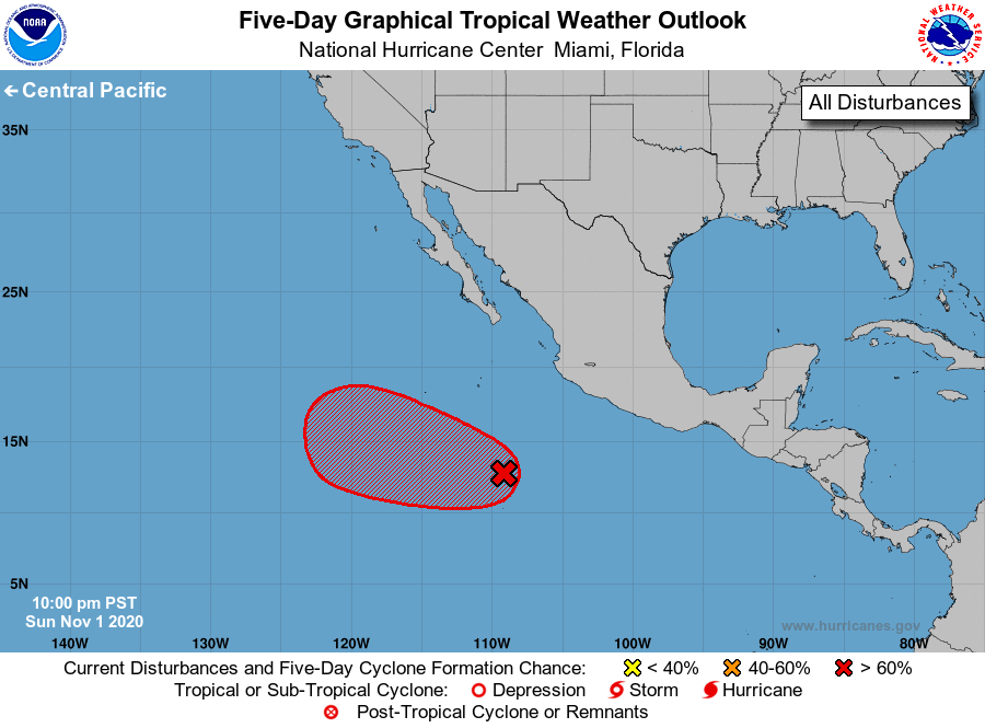
For the eastern North Pacific...east of 140 degrees west longitude:

1. A trough of low pressure located several hundred miles south of 
the southern tip of the Baja California Peninsula is producing a 
broad area of disorganized showers and thunderstorms.  
Environmental conditions appear favorable for gradual development, 
and a tropical depression is likely to form by the middle of the 
week as the system moves west-northwestward, well offshore of the 
coast of Mexico.
* Formation chance through 48 hours...medium...50 percent.
* Formation chance through 5 days...high...80 percent.

Forecaster Pasch


List of Atlantic Outlooks (May 2023 - present)
List of East Pacific Outlooks (May 2023 - present)
List of Central Pacific Outlooks (May 2023 - present)
List of Atlantic Outlooks (July 2014 - April 2023)
List of East Pacific Outlooks (July 2014 - April 2023)
List of Central Pacific Outlooks (June 2019 - April 2023)
List of Atlantic Outlooks (June 2009 - June 2014)
List of East Pacific Outlooks (June 2009 - June 2014)