ZCZC MIATWOEP ALL
TTAA00 KNHC DDHHMM
Tropical Weather Outlook
NWS National Hurricane Center Miami FL
1100 AM PDT Mon Sep 28 2020
For the eastern North Pacific...east of 140 degrees west longitude:
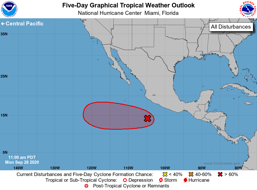
1. Showers and thunderstorms associated with an area of low pressure
located a few hundred miles south of the southwestern coast of
Mexico have increased during the past few hours and have recently
begun to show signs of organization. Additional development is
expected and a tropical depression will likely form during the next
couple of days. The disturbance is forecast to move generally
westward for the next several days and then turn west-northwestward
by the weekend.
* Formation chance through 48 hours...high...80 percent.
* Formation chance through 5 days...high...90 percent.
Forecaster Zelinsky