ZCZC MIATWOEP ALL
TTAA00 KNHC DDHHMM
Tropical Weather Outlook
NWS National Hurricane Center Miami FL
500 PM PDT Fri Sep 4 2020
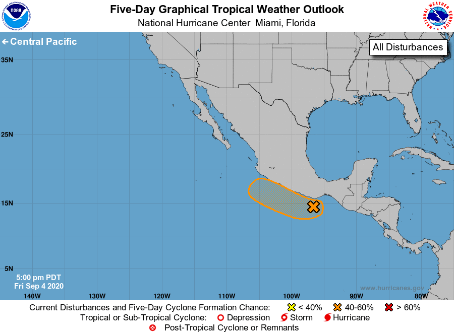
For the eastern North Pacific...east of 140 degrees west longitude:
1. A well-defined low pressure system is located about 100 miles south
of the the southern coast of Mexico. The associated shower and
thunderstorm activity remains displaced well to the west of the
low. Although upper-level winds are forecast to inhibit further
development during the next couple of days, only a small
increase in thunderstorm activity near the surface center of
circulation could result in the formation of a tropical
depression. This system is expected to move generally
west-northwestward, near or along the southern coast of Mexico
during the next few days. Regardless of development, this system
could produce locally heavy rainfall along portions of the coast of
southwestern Mexico. Please consult products from your local
office.
* Formation chance through 48 hours...medium...60 percent.
* Formation chance through 5 days...medium...60 percent.
Forecaster Roberts