ZCZC MIATWOEP ALL
TTAA00 KNHC DDHHMM
Tropical Weather Outlook
NWS National Hurricane Center Miami FL
1100 AM PDT Fri Sep 4 2020
For the eastern North Pacific...east of 140 degrees west longitude:
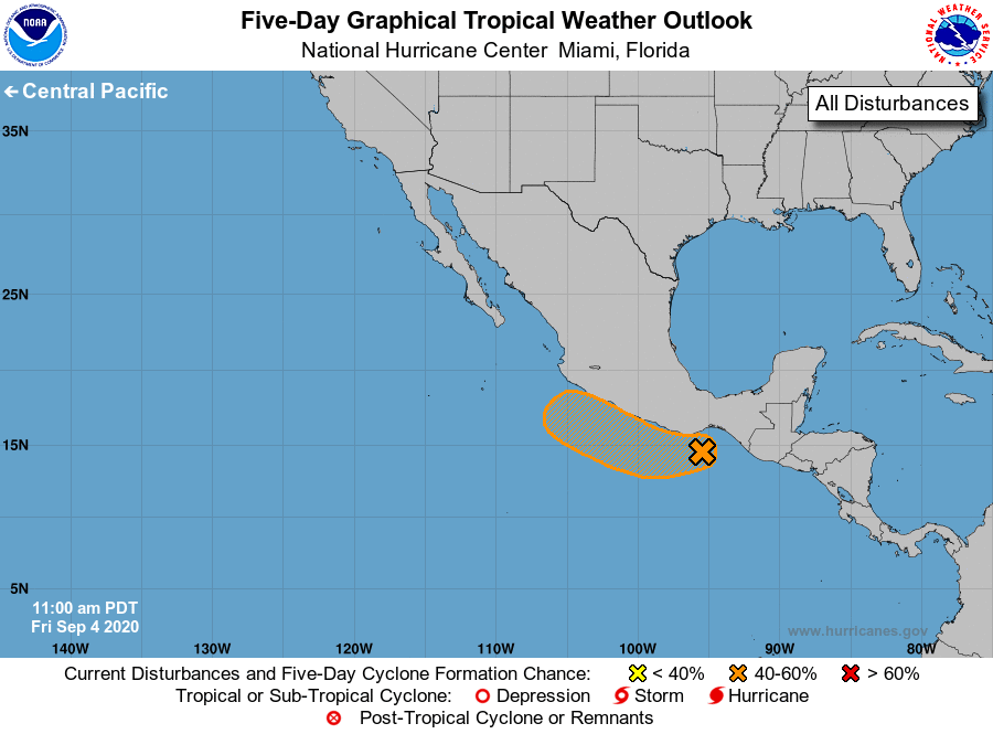
1. A well-defined surface low has formed near the Gulf of Tehuantepec.
Although most of the associated shower and thunderstorm activity is
displaced well to the west of the low, a few showers and
thunderstorms have recently developed near the center. Conditions
are expected to be only marginally conducive for further development
during the next couple of days, but only a small increase in
thunderstorm activity could result in the formation of a tropical
depression. This system is expected to move generally
west-northwestward, near or along the southern coast of Mexico
during the next few days.
* Formation chance through 48 hours...medium...60 percent.
* Formation chance through 5 days...medium...60 percent.
Forecaster Zelinsky