Skip Navigation Links
NOAA NOAA United States Department of Commerce

NHC Graphical Outlook Archive


« Earliest Available         ‹ Earlier         Later ›         Latest Available »
GIS Shapefiles
Central Pacific Eastern Pacific Atlantic

View 2-Day Graphical Tropical Weather Outlook
Click for Atlantic Click for Atlantic

Tropical Weather Outlook Text

ZCZC MIATWOEP ALL
TTAA00 KNHC DDHHMM

Tropical Weather Outlook
NWS National Hurricane Center Miami FL
1100 AM PDT Thu Aug 6 2020

For the eastern North Pacific...east of 140 degrees west longitude:

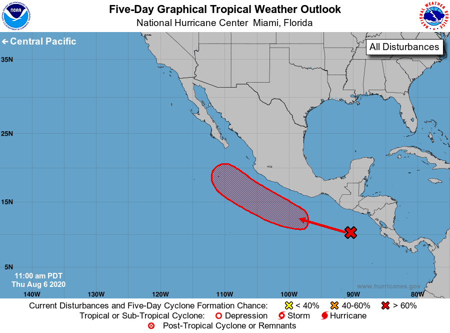
1. Disorganized showers and thunderstorms over the far eastern Pacific 
centered a few hundred miles south of Guatemala are associated with 
a tropical wave. Environmental conditions are forecast to become 
increasingly conducive for development, and a tropical depression 
is likely to form early next week while the system moves generally 
west-northwestward, roughly a couple of hundred miles offshore of 
southwestern Mexico and Baja California Sur.
* Formation chance through 48 hours...low...10 percent.
* Formation chance through 5 days...high...70 percent.

Forecaster Blake


List of Atlantic Outlooks (May 2023 - present)
List of East Pacific Outlooks (May 2023 - present)
List of Central Pacific Outlooks (May 2023 - present)
List of Atlantic Outlooks (July 2014 - April 2023)
List of East Pacific Outlooks (July 2014 - April 2023)
List of Central Pacific Outlooks (June 2019 - April 2023)
List of Atlantic Outlooks (June 2009 - June 2014)
List of East Pacific Outlooks (June 2009 - June 2014)