ZCZC MIATWOEP ALL
TTAA00 KNHC DDHHMM
Tropical Weather Outlook
NWS National Hurricane Center Miami FL
1000 AM PST Fri Nov 15 2019
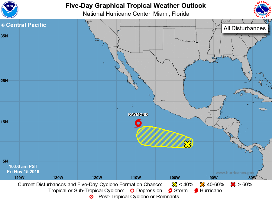
For the eastern North Pacific...east of 140 degrees west longitude:
The National Hurricane Center is issuing advisories on recently
upgraded Tropical Storm Raymond, located several hundred miles
south of the southern tip of the Baja California peninsula.
1. A small area of low pressure located several hundred miles
south-southwest of the Gulf of Tehuantepec continues to produce
disorganized showers and thunderstorms, mainly to the north of the
low. Some gradual development of this disturbance is possible during
the next few days while the system moves westward at around 10 mph.
* Formation chance through 48 hours...low...20 percent.
* Formation chance through 5 days...low...30 percent.
Public Advisories on Tropical Storm Raymond are issued under
WMO header WTPZ35 KNHC and under AWIPS header MIATCPEP5.
Forecast/Advisories on Tropical Storm Raymond are issued
under WMO header WTPZ25 KNHC and under AWIPS header MIATCMEP5.
Forecaster Stewart