ZCZC MIATWOEP ALL
TTAA00 KNHC DDHHMM
Tropical Weather Outlook
NWS National Hurricane Center Miami FL
1100 AM PDT Mon Oct 14 2019
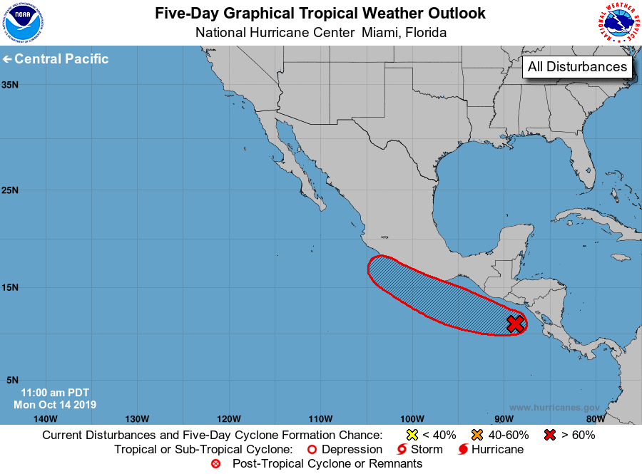
For the eastern North Pacific...east of 140 degrees west longitude:
1. A broad area of low pressure located a couple of hundred miles south
of the coast of El Salvador is producing disorganized showers and
thunderstorms. Gradual development is expected, and a tropical
depression is likely to form within the next few days while the
system moves west-northwestward at about 10 mph near or just
offshore the coast of Guatemala and Mexico. By late this week,
proximity to land could inhibit further development. Heavy rainfall
that is currently occurring across Nicaragua and Honduras is
forecast to spread westward over El Salvador and Guatemala tonight
and Tuesday, and into southern Mexico by Wednesday. These rains
could cause flooding and mudslides, especially in mountainous areas.
* Formation chance through 48 hours...medium...60 percent.
* Formation chance through 5 days...high...80 percent.
Forecaster Latto