ZCZC MIATWOEP ALL
TTAA00 KNHC DDHHMM
Tropical Weather Outlook
NWS National Hurricane Center Miami FL
1100 PM PDT Wed Oct 2 2019
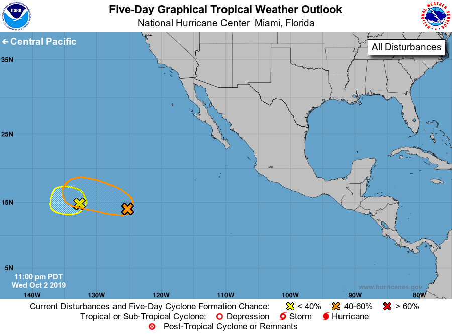
For the eastern North Pacific...east of 140 degrees west longitude:
1. A well-defined low pressure system, located a little more than
1000 miles southwest of the southern tip of the Baja California
peninsula, is producing a small area of thunderstorms near the
center. Gradual development of this disturbance is possible, and a
tropical depression could form during the next several days while
the system moves slowly westward.
* Formation chance through 48 hours...low...30 percent.
* Formation chance through 5 days...medium...40 percent.
2. A small area of low pressure, located about 1500 miles
west-southwest of the southern tip of the Baja California peninsula,
is producing limited shower activity. Development, if any, of this
system should be slow to occur during the next day or two while
the low drifts generally westward and interacts with the larger
disturbance located to the east.
* Formation chance through 48 hours...low...10 percent.
* Formation chance through 5 days...low...10 percent.
Forecaster Stewart