ZCZC MIATWOEP ALL
TTAA00 KNHC DDHHMM
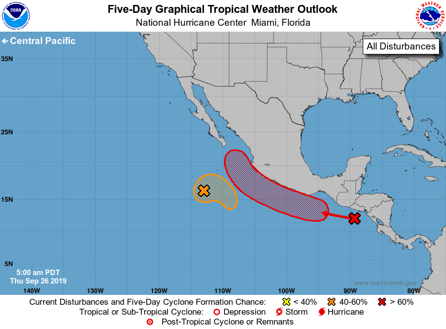
Tropical Weather Outlook
NWS National Hurricane Center Miami FL
500 AM PDT Thu Sep 26 2019
For the eastern North Pacific...east of 140 degrees west longitude:
1. A broad area of low pressure located several hundred miles
south-southwest of the southern tip of the Baja California
peninsula continues to produce disorganized shower activity. Some
development of this system is possible while it moves eastward and
then southeastward during the next couple of days, and a tropical
depression could still form before it becomes absorbed by a larger
weather disturbance near the coast of Mexico over the weekend.
* Formation chance through 48 hours...medium...40 percent.
* Formation chance through 5 days...medium...40 percent.
2. An elongated trough of low pressure is developing near the coast of
southern and southwestern Mexico and is producing several clusters
of disorganized showers and thunderstorms. A low is expected to
form along this trough during the next couple of days, and it is
likely to become a tropical depression over the weekend or early
next week while it moves west-northwestward to northwestward at 10
to 15 mph near the southern and southwestern coasts of Mexico.
Regardless of development, heavy rainfall, with the possibility of
flash flooding and mudslides, is likely along the Pacific coasts of
Central America and southern and southwestern Mexico during the
next several days.
* Formation chance through 48 hours...low...30 percent.
* Formation chance through 5 days...high...80 percent.
Forecaster Berg