ZCZC MIATWOEP ALL
TTAA00 KNHC DDHHMM CCA
Tropical Weather Outlook...Corrected
NWS National Hurricane Center Miami FL
1100 PM PDT Thu Aug 15 2019
Corrected order of paragraphs for graphical product.
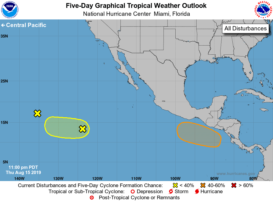
For the eastern North Pacific...east of 140 degrees west longitude:
1. An area of disturbed weather has formed about 1000 miles southwest
of the southern tip of the Baja California peninsula. Although the
associated shower and thunderstorm activity is showing some signs of
organization, the system does not appear to have a well-defined
surface center. Slow development of this disturbance is possible
during the next couple of days while it moves westward across the
tropical eastern Pacific.
* Formation chance through 48 hours...low...10 percent.
* Formation chance through 5 days...low...10 percent.
2. An elongated area of low pressure located about 1700 miles west of
the southern tip of the Baja California peninsula is producing
intermittent showers and thunderstorms. Environmental conditions are
not conducive for development and tropical cyclone formation is not
anticipated. The low is forecast to move generally westward at 10 to
15 mph for the new couple of days.
* Formation chance through 48 hours...near 0 percent.
* Formation chance through 5 days...near 0 percent.
3. An area of low pressure is forecast to form south of the coasts of
El Salvador, Guatemala, and southeastern Mexico in a day or two.
Environmental conditions are expected to be conducive for gradual
development of the low thereafter and a tropical depression could
form by early next week while the system moves slowly westward or
west-northwestward. Regardless of development, moisture associated
with the system is forecast to produce heavy rainfall and possible
flash flooding across portions of Central America during the next
several days.
* Formation chance through 48 hours...low...near 0 percent.
* Formation chance through 5 days...medium...40 percent.
Forecaster Zelinsky