ZCZC MIATWOEP ALL
TTAA00 KNHC DDHHMM
Tropical Weather Outlook
NWS National Hurricane Center Miami FL
1100 PM PDT Fri Jul 26 2019
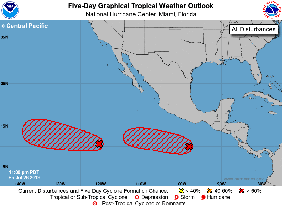
For the eastern North Pacific...east of 140 degrees west longitude:
1. Shower activity associated with an area of disturbed weather located
a little more than 1000 miles southwest of the southern tip of the
Baja California peninsula is gradually becoming better organized.
Environmental conditions are favorable for additional development,
and a tropical depression or tropical storm is likely form either
late this weekend or early next week. This system is expected to
move westward to west-northwestward at 10 to 15 mph.
* Formation chance through 48 hours...high...70 percent.
* Formation chance through 5 days...high...90 percent.
2. An area of low pressure accompanied by disturbed weather is located
a few hundred miles south of the Gulf of Tehuantepec. Gradual
development of this system is expected, and a tropical depression is
likely to form next week while the system moves generally westward
at 15 to 20 mph.
* Formation chance through 48 hours...low...30 percent.
* Formation chance through 5 days...high...80 percent.
Forecaster Beven