ZCZC MIATWOEP ALL
TTAA00 KNHC DDHHMM
Tropical Weather Outlook
NWS National Hurricane Center Miami FL
1100 AM PDT Sun Jul 21 2019
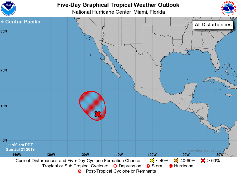
For the eastern North Pacific...east of 140 degrees west longitude:
1. Showers and thunderstorms have increased a little today in
association with a broad area of low pressure located several
hundred miles south-southwest of the southern tip of the Baja
California peninsula. This system appears to lack a well-defined
center. However, conditions are favorable for a tropical depression
or a tropical storm to form during the next day or so as it moves
generally northwestward at around 10 mph, remaining well offshore
the coast of Mexico.
* Formation chance through 48 hours...high...90 percent.
* Formation chance through 5 days...high...90 percent.
Forecaster Latto/Pasch