ZCZC MIATWOEP ALL
TTAA00 KNHC DDHHMM
Tropical Weather Outlook
NWS National Hurricane Center Miami FL
500 PM PDT Sat Jul 20 2019
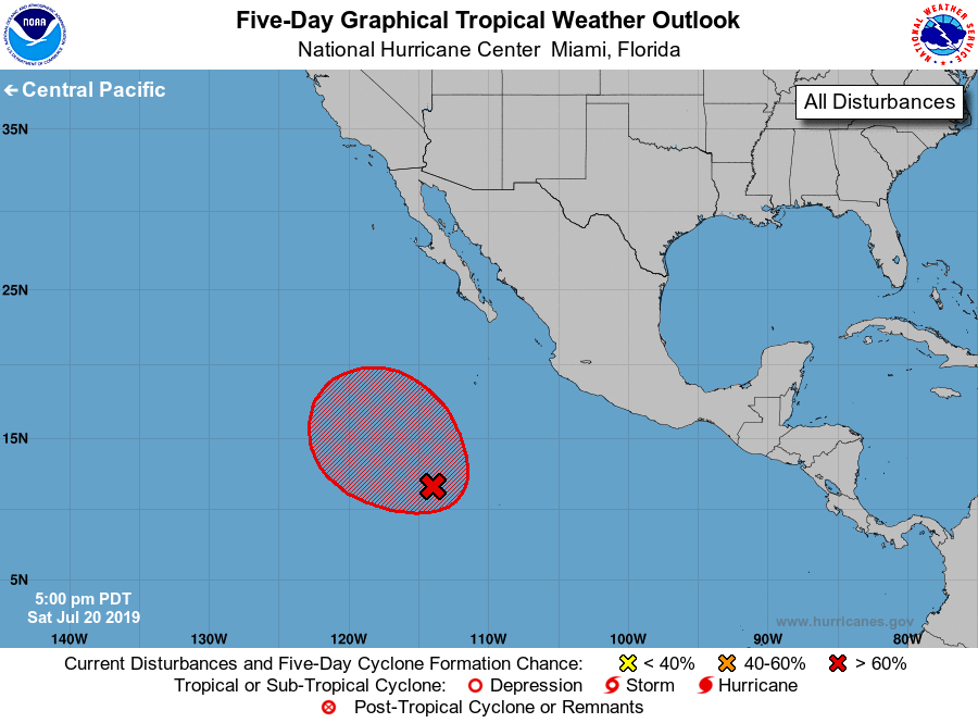
For the eastern North Pacific...east of 140 degrees west longitude:
1. Satellite imagery indicates that a broad and elongated low pressure
area has formed in association with the disturbed weather located
several hundred miles south-southwest of the southern tip of the
Baja California peninsula. Environmental conditions are expected
to be conducive for additional development of this system, and a
tropical depression is likely to form within the next day or two.
This disturbance is forecast to move generally northwestward at
around 10 mph away from the coast of Mexico.
* Formation chance through 48 hours...high...70 percent.
* Formation chance through 5 days...high...90 percent.
Forecaster Brown