ZCZC MIATWOEP ALL
TTAA00 KNHC DDHHMM
Tropical Weather Outlook
NWS National Hurricane Center Miami FL
1100 AM PDT Fri Jul 19 2019
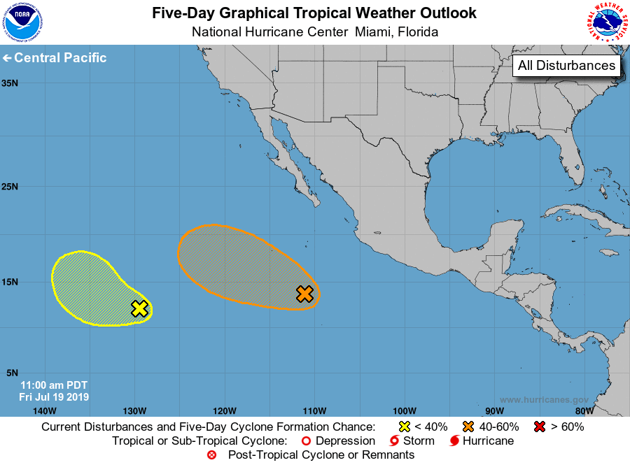
For the eastern North Pacific...east of 140 degrees west longitude:
1. An area of disturbed weather located several hundred miles southwest
of the southwestern coast of Mexico is associated with a tropical
wave. Environmental conditions appear to be conducive for gradual
development, and a tropical depression could form early next week
before the system reaches cooler waters. This disturbance is
forecast to move westward to west-northwestward at 10 to 15 mph,
away from the coast of Mexico.
* Formation chance through 48 hours...low...10 percent.
* Formation chance through 5 days...medium...60 percent.
2. A broad area of low pressure located more than 1500 miles southwest
of the southern tip of the Baja California peninsula is producing an
elongated area of showers and thunderstorms. This system remains
disorganized, and conditions are becoming less conducive for
tropical cyclone formation. The low is expected to move
west-northwestward or northwestward at 10 to 15 mph.
* Formation chance through 48 hours...low...20 percent.
* Formation chance through 5 days...low...20 percent.
Forecaster Pasch