ZCZC MIATWOEP ALL
TTAA00 KNHC DDHHMM
Tropical Weather Outlook
NWS National Hurricane Center Miami FL
1100 AM PDT Thu Jul 18 2019
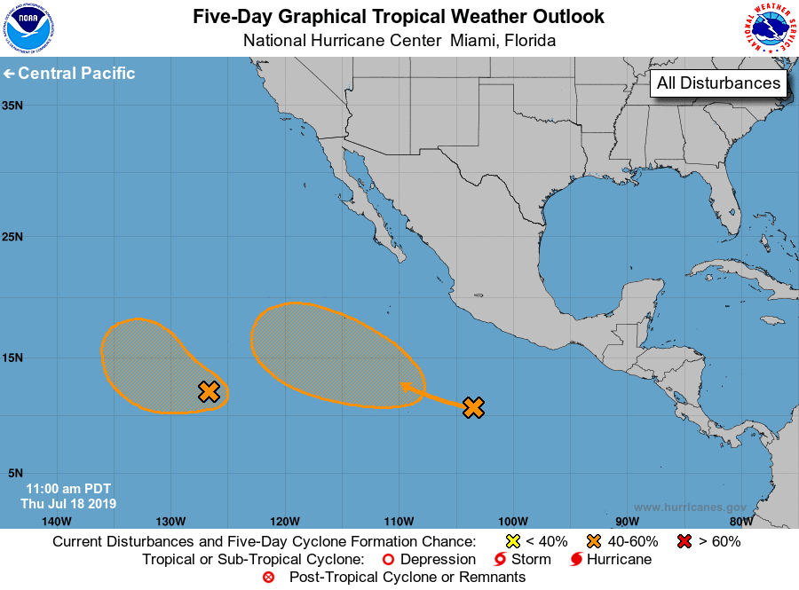
For the eastern North Pacific...east of 140 degrees west longitude:
1. A tropical wave located several hundred miles south of Manzanillo,
Mexico continues to produce disorganized showers and thunderstorms.
Environmental conditions are forecast to become more conducive for
gradual development during the weekend, and a tropical depression
could form early next week. This disturbance is forecast to move
westward to west-northwestward at 10 to 15 mph, away from the coast
of Mexico.
* Formation chance through 48 hours...low...near 0 percent.
* Formation chance through 5 days...medium...50 percent.
2. A broad area of low pressure located about 1350 miles southwest of
the southern tip of the Baja California peninsula is producing a
large area of disorganized showers and thunderstorms. Environmental
conditions are forecast to be conducive for some additional
development during the next two to three days while the disturbance
moves west-northwestward or northwestward at 10 to 15 mph. After
that time, conditions are expected to become less favorable for
development.
* Formation chance through 48 hours...low...30 percent.
* Formation chance through 5 days...medium...40 percent.
Forecaster Brown