ZCZC MIATWOEP ALL
TTAA00 KNHC DDHHMM
Tropical Weather Outlook
NWS National Hurricane Center Miami FL
500 AM PDT Fri Jun 28 2019
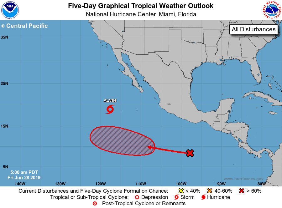
For the eastern North Pacific...east of 140 degrees west longitude:
The National Hurricane Center is issuing advisories on recently
downgraded Tropical Storm Alvin, located several hundred miles
southwest of the southern tip of the Baja California peninsula.
1. A tropical wave located several hundred miles south-southwest
of the Gulf of Tehuantepec is producing disorganized showers and
thunderstorms. Environmental conditions are expected to be
conducive for the development of this system over the next several
days, and a tropical depression is likely to form late this weekend
or early next week while the disturbance moves westward to west-
northwestward well away from the coast of Mexico.
* Formation chance through 48 hours...medium...40 percent.
* Formation chance through 5 days...high...80 percent.
Forecaster Beven