Skip Navigation Links
NOAA NOAA United States Department of Commerce

NHC Graphical Outlook Archive


« Earliest Available         ‹ Earlier         Later ›         Latest Available »
GIS Shapefiles
Central Pacific Eastern Pacific Atlantic

View 2-Day Graphical Tropical Weather Outlook
Click for Atlantic Click for Atlantic

Tropical Weather Outlook Text

ZCZC MIATWOEP ALL
TTAA00 KNHC DDHHMM

Tropical Weather Outlook
NWS National Hurricane Center Miami FL
1100 PM PDT Tue May 21 2019

For the eastern North Pacific...east of 140 degrees west longitude:

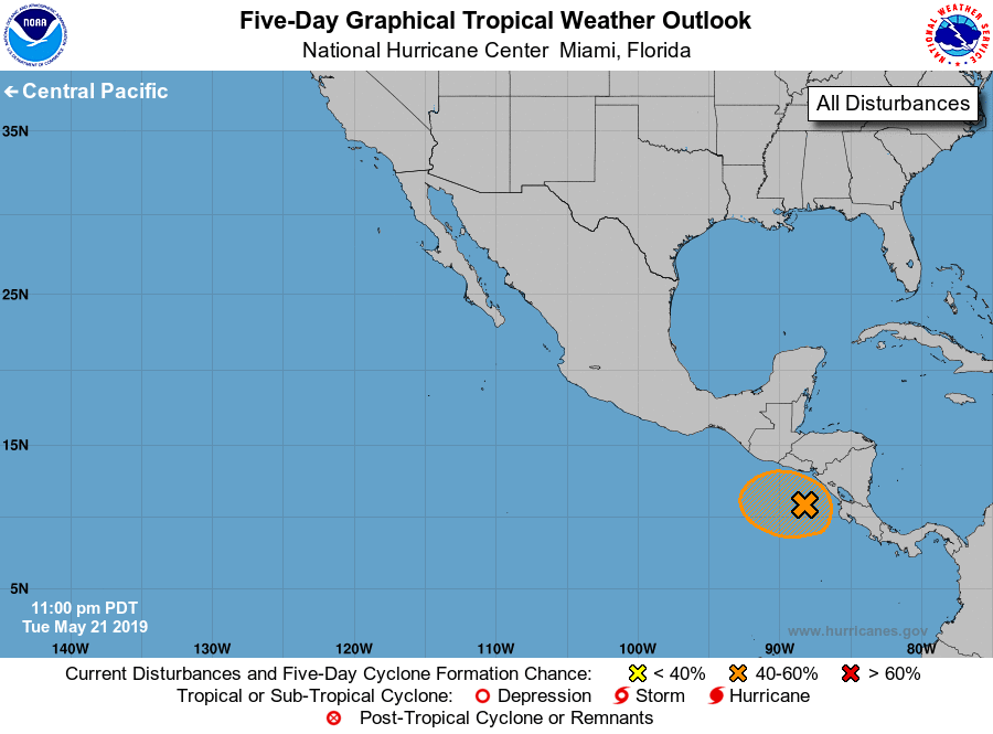
1. A weak area of low pressure located just off the west coast of
Nicaragua is producing disorganized showers and thunderstorms.
This system is expected to continue to meander over the far eastern
North Pacific, and gradual development is possible through the
weekend if the disturbance remains offshore.  Regardless of
development, this low is likely to produce areas of heavy rain
over portions of Central America during the next few days.
* Formation chance through 48 hours...low...20 percent.
* Formation chance through 5 days...medium...50 percent.

Forecaster Cangialosi


List of Atlantic Outlooks (May 2023 - present)
List of East Pacific Outlooks (May 2023 - present)
List of Central Pacific Outlooks (May 2023 - present)
List of Atlantic Outlooks (July 2014 - April 2023)
List of East Pacific Outlooks (July 2014 - April 2023)
List of Central Pacific Outlooks (June 2019 - April 2023)
List of Atlantic Outlooks (June 2009 - June 2014)
List of East Pacific Outlooks (June 2009 - June 2014)