ZCZC MIATWOEP ALL
TTAA00 KNHC DDHHMM
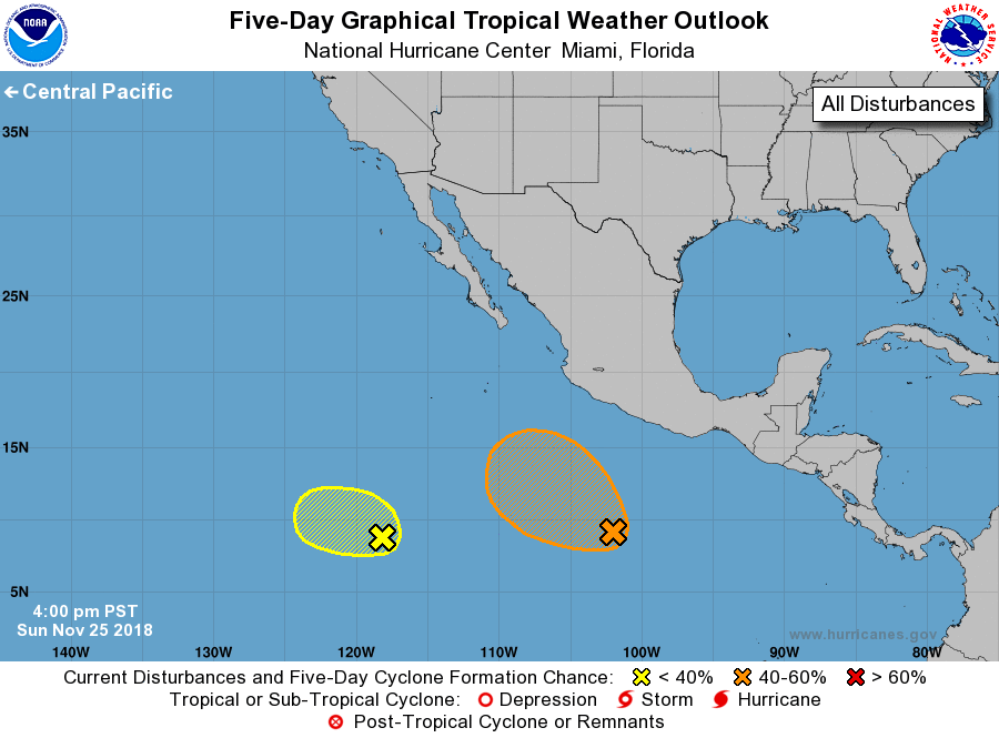
Tropical Weather Outlook
NWS National Hurricane Center Miami FL
400 PM PST Sun Nov 25 2018
For the eastern North Pacific...east of 140 degrees west longitude:
1. An elongated area of low pressure located about 600 miles south-
southwest of Acapulco, Mexico, continues to produce disorganized
showers and thunderstorms. Environmental conditions are expected to
become somewhat conducive for gradual development during the next
several days while the disturbance moves slowly northwestward.
* Formation chance through 48 hours...low...10 percent.
* Formation chance through 5 days...medium...40 percent.
2. Another area of low pressure located about 1150 miles
south-southwest of the southern tip of the Baja California
peninsula is also producing disorganized showers and
thunderstorms. Any development of this system over the next
few days is expected to be slow to occur while it moves slowly
westward.
* Formation chance through 48 hours...low...10 percent.
* Formation chance through 5 days...low...20 percent.
Forecaster Brown