ZCZC MIATWOEP ALL
TTAA00 KNHC DDHHMM
Tropical Weather Outlook
NWS National Hurricane Center Miami FL
1100 AM PDT Wed Oct 31 2018
For the eastern North Pacific...east of 140 degrees west longitude:
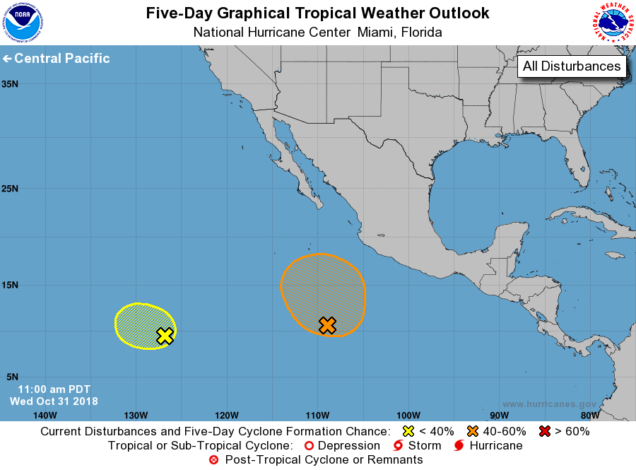
1. Showers and thunderstorms associated with a broad area of low
pressure located about 1400 miles southwest of the southern tip of
the Baja California peninsula remain disorganized. Any development
of this system during the next few days should be slow to occur
while it moves toward the west or west-northwest at 5 to 10 mph.
* Formation chance through 48 hours...low...10 percent.
* Formation chance through 5 days...low...10 percent.
2. A large, but poorly organized, area of disturbed weather is located
several hundred miles south and southwest of the southwestern coast
of Mexico. Environmental conditions are forecast to be conducive
for gradual development of this system during the next several days,
and a tropical depression could form later this week or this weekend
while it moves west-northwestward to northwestward at 5 to 10 mph.
* Formation chance through 48 hours...low...20 percent.
* Formation chance through 5 days...medium...60 percent.
Forecaster Beven