ZCZC MIATWOEP ALL
TTAA00 KNHC DDHHMM
Tropical Weather Outlook
NWS National Hurricane Center Miami FL
1100 AM PDT Sat Oct 13 2018
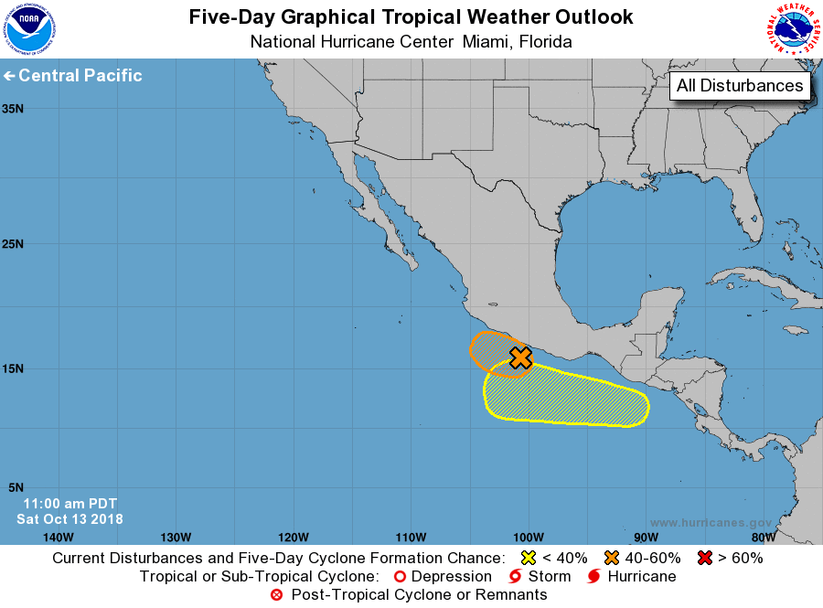
For the eastern North Pacific...east of 140 degrees west longitude:
1. A small, well-defined low pressure system located more than 100
miles southwest of Acapulco, Mexico, continues to produce a
concentrated area of showers and thunderstorms near and just west
of the center. Upper-level winds are expected to be marginally
conducive for development of a tropical depression during the next
few days while the disturbance moves moves slowly westward to
west-northwestward parallel to the southwestern coast of Mexico.
However, only a slight deviation to the right or north of the
expected track would bring the small low and its heavy rains closer
to or even inland along the southwestern coast of Mexico, which
would inhibit further development. Interests in this area should
monitor the progress of this system as well as products issued by
the Mexican Meteorological Service.
* Formation chance through 48 hours...medium...50 percent.
* Formation chance through 5 days...medium...60 percent.
2. A low pressure area is forecast to develop a few hundred miles south
of the southeastern coast of Mexico around the middle of next week.
Environmental conditions are expected to be somewhat favorable for
development of the system while it moves generally westward, well
offshore the coast of Mexico.
* Formation chance through 48 hours...low...near 0 percent.
* Formation chance through 5 days...low...20 percent.
Forecaster Stewart