ZCZC MIATWOEP ALL
TTAA00 KNHC DDHHMM
Tropical Weather Outlook
NWS National Hurricane Center Miami FL
500 PM PDT Sun Sep 23 2018
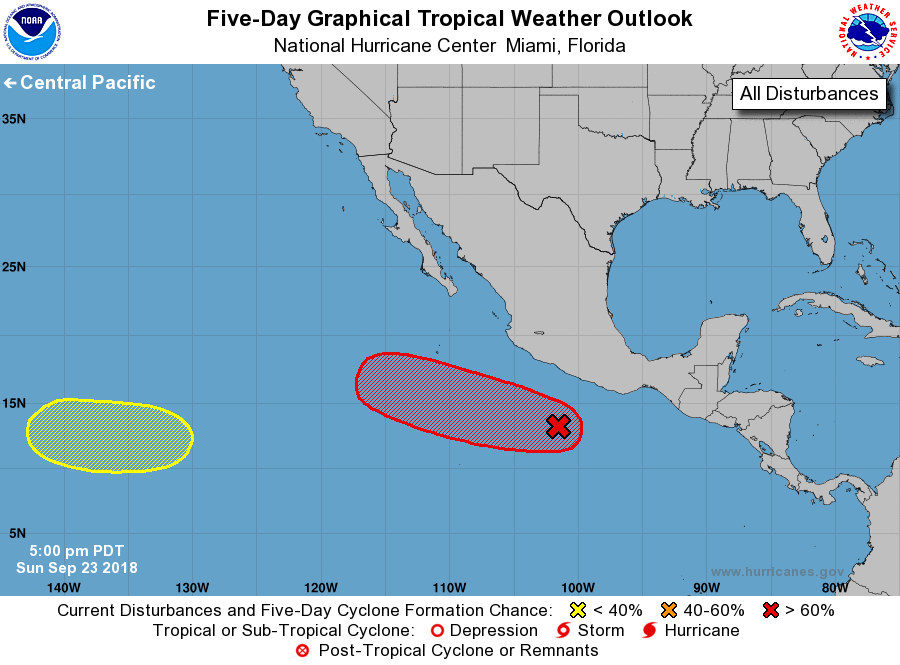
For the eastern North Pacific...east of 140 degrees west longitude:
1. A broad area of low pressure located a couple of hundred miles
south-southwest of Acapulco, Mexico, is beginning to show signs of
organization. Environmental conditions are expected to be conducive
for further development and a tropical depression is likely to from
within the next few days while it moves west-northwestward well off
the coast of Mexico.
* Formation chance through 48 hours...medium...50 percent.
* Formation chance through 5 days...high...90 percent.
2. An area of low pressure is expected to form over the far western
portion of the eastern North Pacific basin by the middle of the
week. Some gradual development of this system is possible after
that time while it moves westward toward the central Pacific.
* Formation chance through 48 hours...low...near 0 percent.
* Formation chance through 5 days...low...30 percent.
Forecaster Zelinsky