ZCZC MIATWOEP ALL
TTAA00 KNHC DDHHMM
Tropical Weather Outlook
NWS National Hurricane Center Miami FL
500 PM PDT Tue Sep 11 2018
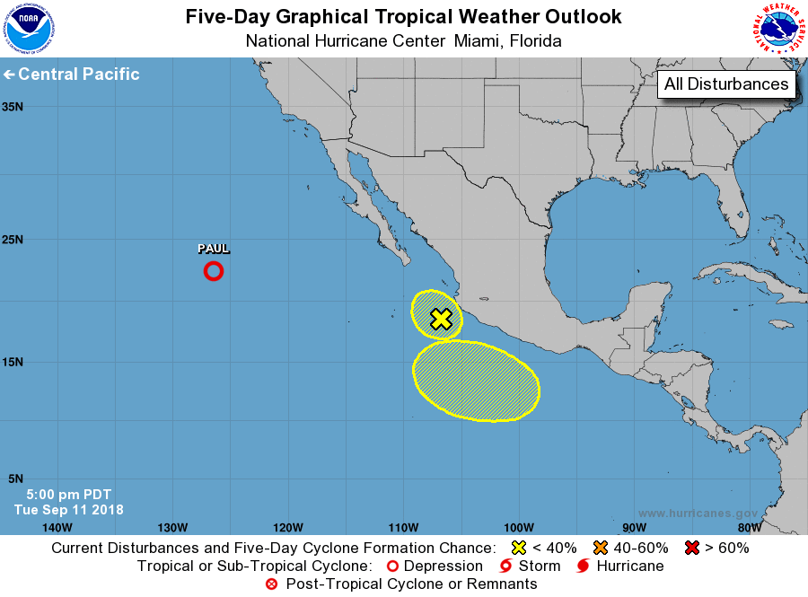
For the eastern North Pacific...east of 140 degrees west longitude:
The National Hurricane Center is issuing advisories on Tropical
Depression Paul, located about 1000 miles west of the southern tip
of the Baja California peninsula.
1. Disorganized showers and thunderstorms extending several hundred
miles off the west-central coast of Mexico are associated with a
trough of low pressure. Recent satellite-derived wind data indicate
that the system does not have a surface circulation, and
development is not likely while it moves little during the next
couple of days.
* Formation chance through 48 hours...low...10 percent.
* Formation chance through 5 days...low...10 percent.
2. An area of low pressure is expected to develop well south of the
southwestern coast of Mexico in a few days. Some gradual
development is possible after that time while the system moves
generally westward to west-northwestward.
* Formation chance through 48 hours...low...near 0 percent.
* Formation chance through 5 days...low...30 percent.
Forecaster Berg