ZCZC MIATWOEP ALL
TTAA00 KNHC DDHHMM
Tropical Weather Outlook
NWS National Hurricane Center Miami FL
1100 AM PDT Fri Aug 31 2018
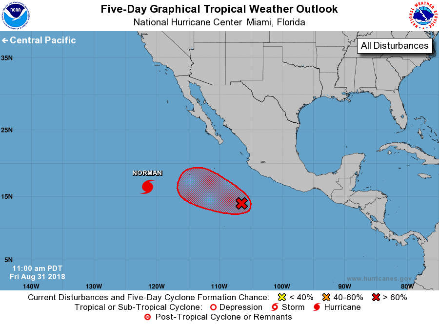
For the eastern North Pacific...east of 140 degrees west longitude:
The National Hurricane Center is issuing advisories on Hurricane
Norman, located a little over 800 miles west-southwest of the
southern tip of the Baja California peninsula.
1. Showers and thunderstorms, associated with a low pressure system
located several hundred miles south-southwest of Manzanillo,
Mexico continue to show signs of organization. Additional
development is expected and a tropical depression is likely to form
later today or on Saturday while the system moves generally
west-northwestward, away from the coast of Mexico.
* Formation chance through 48 hours...high...80 percent.
* Formation chance through 5 days...high...90 percent.
Forecaster Roberts