ZCZC MIATWOEP ALL
TTAA00 KNHC DDHHMM
Tropical Weather Outlook
NWS National Hurricane Center Miami FL
500 PM PDT Wed Aug 29 2018
For the eastern North Pacific...east of 140 degrees west longitude:
The National Hurricane Center is issuing advisories on recently
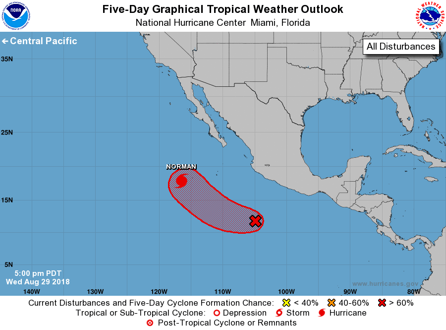
upgraded Hurricane Norman, located several hundred miles southwest
of the southern tip of the Baja California. The National Hurricane
Center has issued its last advisory on recently upgraded Hurricane
Miriam, which is moving into the central Pacific basin.
1. Disorganized showers and thunderstorms located several hundred miles
southwest of Acapulco, Mexico, are associated with a broad area of
low pressure. Environmental conditions are expected to be conducive
for gradual development over the next several days, and a tropical
depression is likely to form this weekend or early next week while
the system moves west-northwestward away from the coast of Mexico.
* Formation chance through 48 hours...low...20 percent.
* Formation chance through 5 days...high...70 percent.
Forecaster Beven