ZCZC MIATWOEP ALL
TTAA00 KNHC DDHHMM
Tropical Weather Outlook
NWS National Hurricane Center Miami FL
500 PM PDT Mon Aug 6 2018
For the eastern North Pacific...east of 140 degrees west longitude:
The National Hurricane Center is issuing advisories on Tropical
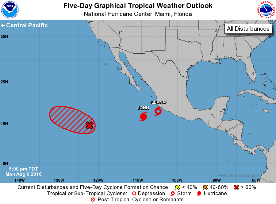
Storm Ileana, located a little more than a hundred miles
south-southeast of Manzanillo, Mexico, and on Hurricane John,
located a few hundred miles south-southeast of the southern tip
of the Baja California Peninsula.
1. Shower activity associated with an elongated area of low pressure
located about 1000 miles southwest of the southern tip of the Baja
California peninsula continues to show some signs of organization.
Environmental conditions appear conducive for development, and a
tropical depression is likely to form during the next couple of days
while the system moves slowly toward the west-northwest at 5 to 10
mph.
* Formation chance through 48 hours...high...70 percent.
* Formation chance through 5 days...high...80 percent.
Forecaster Avila