Skip Navigation Links
NOAA NOAA United States Department of Commerce

NHC Graphical Outlook Archive


« Earliest Available         ‹ Earlier         Later ›         Latest Available »
GIS Shapefiles
tab Eastern North Pacific tab tab Atlantic tab

View 2-Day Graphical Tropical Weather Outlook
Click for Atlantic Click for Atlantic

Tropical Weather Outlook Text

ZCZC MIATWOEP ALL
TTAA00 KNHC DDHHMM

Tropical Weather Outlook
NWS National Hurricane Center Miami FL
500 AM PDT Wed Jul 11 2018

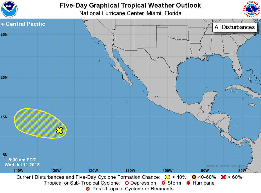
For the eastern North Pacific...east of 140 degrees west longitude:

1. A broad trough of low pressure located about 1500 miles southwest of
the southern tip of the Baja California peninsula is producing
disorganized showers and a few thunderstorms.  Despite marginally
conducive environmental conditions, the broad nature of the
disturbance is expected to inhibit any significant development while
it moves westward over the next several days.
* Formation chance through 48 hours...low...near 0 percent
* Formation chance through 5 days...low...10 percent

Forecaster Zelinsky


List of Atlantic Outlooks (May 2023 - present)
List of East Pacific Outlooks (May 2023 - present)
List of Central Pacific Outlooks (May 2023 - present)
List of Atlantic Outlooks (July 2014 - April 2023)
List of East Pacific Outlooks (July 2014 - April 2023)
List of Central Pacific Outlooks (June 2019 - April 2023)
List of Atlantic Outlooks (June 2009 - June 2014)
List of East Pacific Outlooks (June 2009 - June 2014)