ZCZC MIATWOEP ALL
TTAA00 KNHC DDHHMM
Tropical Weather Outlook
NWS National Hurricane Center Miami FL
500 AM PDT Wed Jun 13 2018
For the eastern North Pacific...east of 140 degrees west longitude:
The National Hurricane Center is issuing advisories on recently
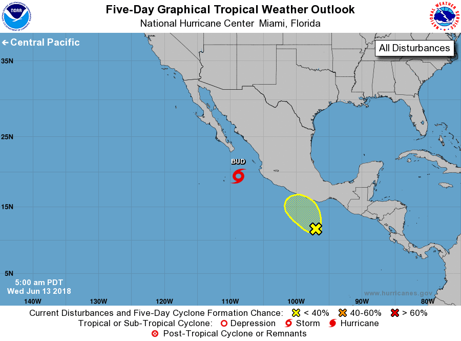
downgraded Tropical Storm Bud, located a few hundred miles
south-southeast of the southern tip of the Baja California
peninsula.
1. An area of low pressure centered several hundred miles south-
southwest of the Gulf of Tehuantepec has become better defined
since yesterday. Environmental conditions are forecast to be
somewhat conducive, and slow development could occur during the
next couple of days as the system drifts north-northwestward. By
the weekend, interaction with land is expected to limit further
organization. Regardless of development, locally heavy rain
causing flash floods and mudslides is possible over the southern
portions of the Mexican states of Guerrero and Oaxaca beginning in
a day or so and continuing into the weekend.
* Formation chance through 48 hours...low...20 percent.
* Formation chance through 5 days...low...30 percent.
Forecaster Blake