ZCZC MIATWOEP ALL
TTAA00 KNHC DDHHMM
Tropical Weather Outlook
NWS National Hurricane Center Miami FL
1100 AM PDT Tue Jun 5 2018
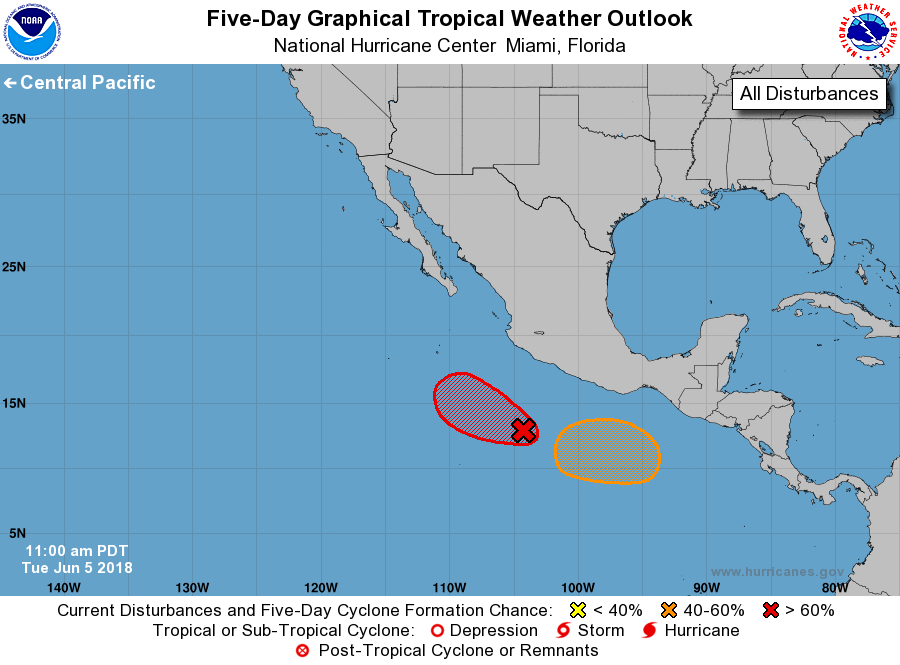
For the eastern North Pacific...east of 140 degrees west longitude:
1. Showers and thunderstorms associated with an area of low pressure
located a few hundred miles south of Manzanillo, Mexico, are
becoming better organized. In addition, satellite images indicate
that the circulation of the system is now better defined. Continued
development of this system is expected, and it will likely become a
tropical depression later today or tonight while it moves slowly
westward to west-northwestward south of the coast of Mexico.
* Formation chance through 48 hours...high...near 100 percent.
* Formation chance through 5 days...high...near 100 percent.
2. An area of low pressure is expected to form late this week a
few hundred miles south of the Gulf of Tehuantepec. Upper-level
winds are forecast to gradually become more favorable for
development, and a tropical depression could form over the weekend
while the system moves slowly west-northwestward.
* Formation chance through 48 hours...low...near 0 percent.
* Formation chance through 5 days...medium...50 percent.
Forecaster Cangialosi