ZCZC MIATWOEP ALL
TTAA00 KNHC DDHHMM
Tropical Weather Outlook
NWS National Hurricane Center Miami FL
500 AM PDT Tue Jun 5 2018
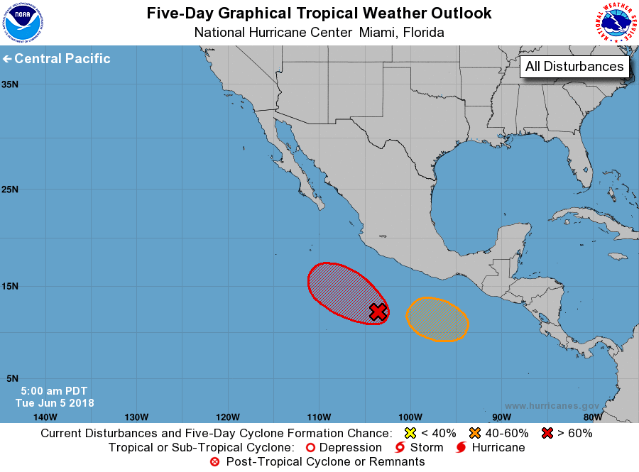
For the eastern North Pacific...east of 140 degrees west longitude:
1. Showers and thunderstorms have become more concentrated overnight
near an elongated area of low pressure located several hundred miles
south of the southern coast of Mexico. Environmental conditions are
conducive for further development of this system, and a tropical
depression or tropical storm is expected to form within the next
couple of days while it moves slowly westward to west-northwestward.
* Formation chance through 48 hours...high...80 percent.
* Formation chance through 5 days...high...90 percent.
2. An area of low pressure could form by Friday a few hundred miles
south of the Gulf of Tehuantepec. Upper-level winds are forecast
gradually become more favorable for development, and a tropical
depression could form over the weekend while the system moves
slowly west-northwestward.
* Formation chance through 48 hours...low...near 0 percent.
* Formation chance through 5 days...medium...40 percent.
Forecaster Blake