ZCZC MIATWOEP ALL
TTAA00 KNHC DDHHMM
Special Tropical Weather Outlook
NWS National Hurricane Center Miami FL
1215 AM PDT Wed May 9 2018
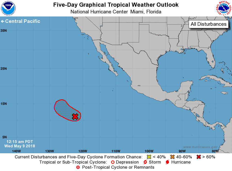
For the eastern North Pacific...east of 140 degrees west longitude:
1. Satellite images indicate that showers and thunderstorms have become
a little better organized this morning in association with a broad
area of low pressure located more than 1100 miles southwest of the
southern tip of the Baja California peninsula. Although recent
satellite-derived surface wind data indicate winds of 30 to 35 mph
were occurring on the northwest side of the disturbance, the
low-level circulation remains elongated. However, only a slight
increase in the amount and organization of the thunderstorm activity
or an improvement in the surface wind field would result in the
formation of a tropical depression later today while the system
moves northwestward at around 10 mph. By late Thursday, upper-level
winds are expected to become unfavorable for tropical cyclone
formation. A Special Tropical Weather Outlook on this system will be
issued by 11 AM PDT later today, if necessary.
* Formation chance through 48 hours...high...70 percent.
* Formation chance through 5 days...high...70 percent.
Forecaster Stewart