ZCZC MIATWOEP ALL
TTAA00 KNHC DDHHMM
Tropical Weather Outlook
NWS National Hurricane Center Miami FL
1100 AM PDT Thu Sep 21 2017
For the eastern North Pacific...east of 140 degrees west longitude:
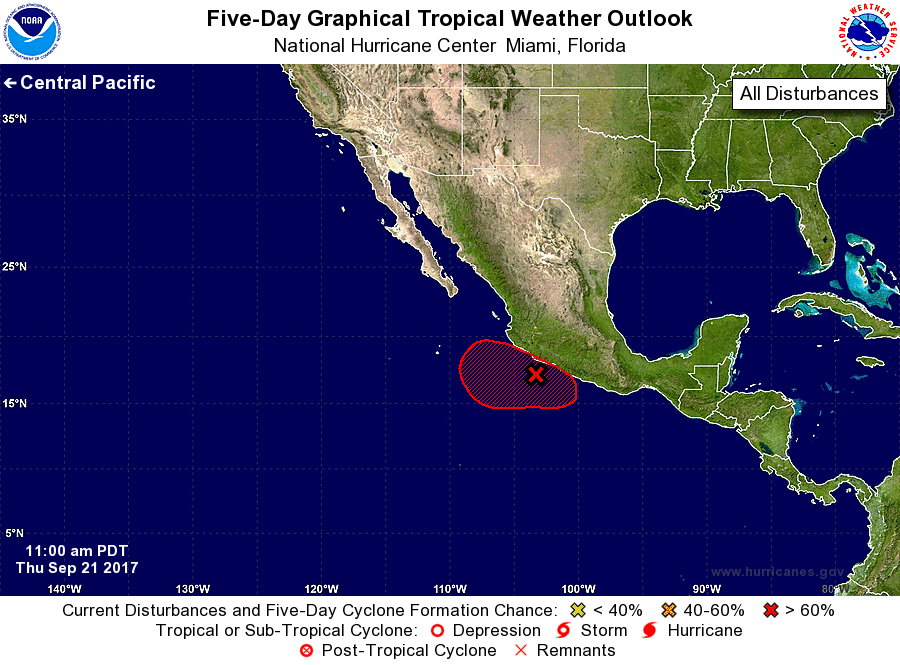
1. Shower and thunderstorm activity associated with a broad area of low
pressure located just offshore of the southwestern coast of Mexico
is beginning to show some signs of organization. Environmental
conditions are expected to be conducive for gradual development,
and a tropical depression is likely to form during the next couple
of days as the system drifts west-northwestward to westward.
Regardless of tropical cyclone formation, heavy rains are expected
over portions of southwestern Mexico during the next several days.
* Formation chance through 48 hours...high...70 percent.
* Formation chance through 5 days...high...90 percent.
Forecaster Stewart