ZCZC MIATWOEP ALL
TTAA00 KNHC DDHHMM
Tropical Weather Outlook
NWS National Hurricane Center Miami FL
500 PM PDT Mon Aug 14 2017
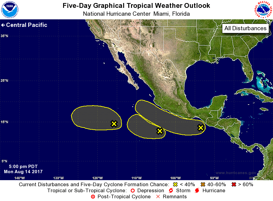
For the eastern North Pacific...east of 140 degrees west longitude:
1. An area of disturbed weather is located several hundred miles
southwest of the southern tip of the Baja California peninsula.
Some development of this system is possible later this week while
it moves slowly westward.
* Formation chance through 48 hours...low...10 percent.
* Formation chance through 5 days...low...30 percent.
2. Showers and thunderstorms associated with a trough of low pressure
located several hundred miles southwest of Acapulco, Mexico, have
not become any better organized since yesterday. Development of
this system has become less likely while it continues moving slowly
westward or west-northwestward.
* Formation chance through 48 hours...low...near 0 percent.
* Formation chance through 5 days...low...20 percent.
3. A tropical wave near the Gulf of Tehuantepec is producing scattered
showers and thunderstorms. Some development of this system is
possible in a few days while it moves westward to west-northwestward
at 10 to 15 mph.
* Formation chance through 48 hours...low...near 0 percent.
* Formation chance through 5 days...low...20 percent.
Forecaster Pasch