ZCZC MIATWOEP ALL
TTAA00 KNHC DDHHMM
Tropical Weather Outlook
NWS National Hurricane Center Miami FL
1100 AM PDT Thu Aug 3 2017
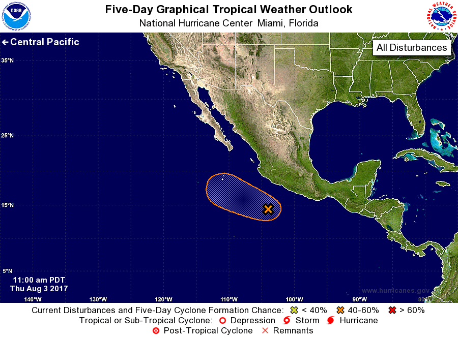
For the eastern North Pacific...east of 140 degrees west longitude:
1. Showers and thunderstorms associated with a tropical wave located a
few hundred miles southwest of Acapulco, Mexico, have become more
organized this morning. Satellite imagery indicates that a surface
circulation may also be forming. Environmental conditions are
expected to support some additional development for the next day or
two, before becoming unfavorable by the weekend. This disturbance
should move west-northwestward at about 15 mph for the next few
days.
* Formation chance through 48 hours...medium...40 percent.
* Formation chance through 5 days...medium...40 percent.
Forecaster Zelinsky